
A demo that works flawlessly in a 3-meter meeting room can fall apart when you need to cover a 10-meter exhibition wall, a curved dome, or an L-shaped corridor. The culprit is rarely sensor quality — it’s the assumption that one sensor can see everything. Multi-LiDAR cascading solves this by assigning each unit a specific zone and stitching the results into a single, seamless interactive field.
POELIDAR-F1 units cascaded on a single PC, covering 360° rooms, 10m+ walls, curved domes, and multi-surface installations — with unified touch tracking across all zones.
1. Why One Sensor Isn’t Enough
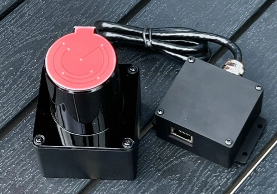
A single LiDAR has a finite field of view — 270° for the POELIDAR-F1. Beyond its detection cone, surfaces go dark. Three problems emerge in large spaces:
- Coverage gaps — areas outside the sensor’s field of view get no touch tracking.
- Accuracy drop-off at range — touch precision degrades at the far edges. The F1 delivers <2 cm accuracy at 6m but <3 cm at 10m.
- Mounting constraints — in irregular rooms (L-shapes, domes, multi-level), no single position provides full line-of-sight.
The solution is not a better sensor — it’s a different architecture.
2. How Multi-LiDAR Cascading Works
Instead of one sensor covering everything, you assign each POELIDAR-F1 a specific zone and merge the data in software. The visitor experiences one seamless interactive field. Behind the scenes, a coordinated sensor network handles the complexity.
| Layer | What It Does |
|---|---|
| Sensor | Each F1 scans its zone at up to 30 FPS using TOF laser ranging. Units connect via standard Ethernet with POE power — one cable for data and power. |
| Network | All data streams through a single managed switch to one host computer. POE standard IEEE 802.3AF supports transmission distances over 100 meters. |
| Fusion | CPJROBOT’s software merges touch data into a unified coordinate space. Overlapping zones use deduplication to avoid double-counting. Output is a single, clean TUIO stream. |
| Application | Delivered via TUIO protocol, Windows multi-point (up to 256 points), or mouse simulation. Compatible with Unity, C#, C++, Processing, and TouchDesigner. |
Key insight: The sensor layer and the display layer are completely independent. The LiDAR tracks where people touch; the content team controls what appears on screen — with no constraints from the sensor hardware.
3. Five Real-World Scenarios
3.1 10-Meter+ Ultra-Wide Walls
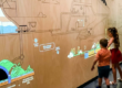
One F1 covers 6–8m of wall width with optimal accuracy. For a 12m wall, two or three units mounted along the ceiling each cover a segment with intentional overlap. A visitor swipes from end to end — the tracking follows continuously, no dead zones, no position jumps.
3.2 Curved Surfaces & Domes
Curved projection surfaces create blind angles for single sensors. With cascading, multiple units are angled to match the surface geometry. Four F1s on a ceiling grid can cover an entire dome — the visitor touches any point, and the system registers it regardless of which unit detected it.
3.3 Floor + Wall Combinations
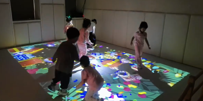
Two units — one angled toward the floor, one toward the wall — share the same control system. A gesture starting on the floor and sweeping upward reads as one continuous interaction, with seamless coordinate handoff at the physical boundary.
3.4 L-Shaped & Corridor Spaces
Two or three units handle the geometry where a single sensor loses line-of-sight at the angle change. Overlapping coverage at the corner creates one continuous interactive corridor.
3.5 360° Immersive Rooms
Four to six F1 units mounted on a ceiling grid cover all four walls plus the floor in CAVE-style rooms. Visitors move freely; the system tracks everyone, everywhere, with zero blind spots.
4. Technical Foundation: TOF, TUIO & Custom Zones
The POELIDAR-F1 uses Time-of-Flight (TOF) laser ranging — absolute distance measurements unaffected by ambient light, surface color, or contrast. Each unit can be assigned a custom interaction polygon (triangle, hexagon, L-shape, freeform). Adjacent zones can overlap, creating a transition buffer where both sensors contribute data.
All fused touch data outputs via the TUIO protocol — the de facto standard for multi-touch surfaces. The fusion layer assigns each touch point a unique session ID and tracks it across sensor boundaries. A finger moving from sensor A’s zone into sensor B’s zone keeps the same ID — the application sees one continuous cursor.
5. Three Factors That Make or Break a Cascade
| Factor | Best Practice |
|---|---|
| Calibration Accuracy | Use CPJROBOT’s auto-calibration tools. Test with a continuous swipe across all zone boundaries before going live. |
| Network Stability | Dedicated network for the sensor array — no shared bandwidth. CAT6 or better cable, gigabit switch with POE (IEEE 802.3AF). |
| Frame Rate Consistency | Configure all units to the same frame rate (25–30 FPS recommended). Mismatched rates cause stutter at zone boundaries. |
6. Display Compatibility
The LiDAR system is completely display-agnostic. It works with front/rear projection, edge-blended multi-projector arrays, LED panels and tile screens of any size, spliced displays, and projection onto walls, floors, tables, or architectural surfaces. The sensor tracks touch — the display renders content. They don’t constrain each other.
7. Planning Your Cascade
Before deciding on sensor count, answer these four questions:
- Total interactive surface area? Determines minimum unit count.
- Any non-planar surfaces? Curves, angles, or domes need extra units.
- Mounting height? Optimal: 2.5–4m above the surface.
- High-traffic touch zones? Consider overlapping coverage for redundancy.
Rule of thumb: one F1 per 6–8m of wall width, or one per 25–35 m² of floor area, with overlap at boundaries.
8. Frequently Asked Questions
Q: How many POELIDAR-F1 units can one PC support?
A: 20+ units through a standard managed Ethernet switch with POE. The practical limit is your CPU’s capacity for processing the combined touch data streams.
Q: Do I need special software for sensor fusion?
A: No. CPJROBOT provides free calibration and fusion software that handles zone definition, coordinate merging, and TUIO output. Your application receives a single unified touch stream.
Q: What happens at overlapping zone boundaries?
A: A deduplication algorithm merges touch points detected by both sensors. Each touch keeps a unique session ID tracked continuously across boundaries — no double-tap, no position jump.
Q: Can I use multi-LiDAR cascading outdoors?
A: Yes. The F1 is rated IP65 waterproof and dustproof, with an operating range of -20°C to 60°C. Use weatherproof cabling and a protected switch enclosure.
You might be interested in:
Multi-LiDAR Interactive Systems: What Venue Owners Need to Know
Building Truly Immersive Spaces: What LiDAR Cascade Makes Possible
How to Scale LiDAR Touch Systems Across Large Venues