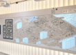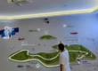

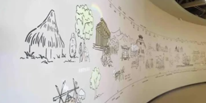
Large immersive exhibition spaces require more than powerful projectors and high-resolution visual content.
When visitors interact across long walls, wide floors, or multiple projection zones, the sensing system must provide reliable coverage and consistent position data.
A single LiDAR sensor may not cover every intended interaction area, especially when architectural obstacles or complex layouts create detection gaps.
How can multiple LiDAR sensors work together across a large immersive installation?
This guide focuses on the engineering challenges of multi-LiDAR network deployment, coordinate integration, touch-event tracking, latency, and commissioning.
1. Why Large Immersive Spaces Need Multi-LiDAR Systems
Large exhibition environments often include:
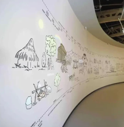
- Panoramic interactive walls
- Multi-projector immersive rooms
- Wide interactive floors
- Connected exhibition corridors
- Irregular architectural surfaces
- Multiple independent visitor interaction zones
In these installations, sensor coverage is affected by distance, field of view, mounting position, and physical obstructions.
Using multiple LiDAR sensors allows system integrators to divide the venue into manageable sensing regions.
The goal is not simply to install more sensors, but to create a coordinated system that delivers usable interaction data to the application.
2. Multi-LiDAR System Architecture
A typical network-based multi-LiDAR interactive projection system includes:
- Multiple LiDAR sensors
- A compatible PoE network switch
- Ethernet cabling
- A processing computer or server
- Sensor calibration and coordinate-integration software
- An interactive application
- Projectors or LED display systems
How the Data Flows
Each LiDAR sensor measures objects within its scanning plane.
The processing software receives data from the sensors and converts the measurements into a common coordinate system.
The application then receives position-based events and triggers the corresponding visual effects.
LiDAR Sensors → Ethernet Network → Coordinate Processing → Interactive Application → Projection Output
This architecture allows multiple sensing regions to contribute to a larger interactive installation.
3. Planning the Network for Multiple PoE LiDAR Sensors
Network design is important because unstable communication can interrupt the interactive experience.
Select a Suitable PoE Switch
For CPJROBOT F1 PoE LiDAR installations, use network equipment compatible with the sensor’s IEEE 802.3af PoE requirements.
The switch must provide sufficient power for all connected sensors.
A switch with enough Ethernet ports may still be unsuitable if its total PoE power budget is insufficient.
Plan IP Address Management
Each networked LiDAR sensor must be identifiable by the processing software.
Use a documented addressing scheme appropriate to the device configuration.
Check for duplicate IP addresses, incorrect subnet settings, and blocked communication ports.
Check Network Capacity
A multi-LiDAR system sends several sensor data streams to the processing computer.
The required bandwidth depends on sensor output, communication protocol, and data processing architecture.
Avoid assuming that the number of available network ports alone determines system capacity.
Protect Network Infrastructure
For permanent public installations, place switches and power equipment in accessible, protected locations.
Document cable routes, device addresses, and configuration settings for future maintenance.
4. Multi-LiDAR Coordinate Fusion and Touch Tracking
One of the most important engineering tasks is aligning multiple sensing regions.
Each LiDAR sensor measures positions relative to its own coordinate system.
To create a shared interactive area, the software must transform these positions into a common coordinate space.
Coordinate Alignment
A practical workflow includes:
- Define the active area for each sensor.
- Establish reference positions.
- Calibrate each sensor.
- Align adjacent sensing regions.
- Verify interaction positions across boundaries.
- Save and document the configuration.
Preventing Duplicate Touch Events
When two sensors detect the same object in an overlapping area, the software may receive two measurements for one interaction.
A suitable coordinate-fusion system can evaluate whether these measurements represent the same object.
Depending on the supported software, duplicate detections may be merged or filtered.
Maintaining Touch IDs Across Sensor Boundaries
Some interactive applications use touch identifiers to maintain continuity while an object moves.
For example, a visitor may drag a projected object from one detection zone into another.
If the tracking system creates a new ID at the boundary, the application may interpret the movement as a released touch followed by a new touch.
Continuous ID tracking requires appropriate association logic and should be tested with the actual sensor-fusion software.
A 2D LiDAR touch ID identifies a detected interaction track; it does not necessarily identify a particular person or distinguish their hands and feet.
5. How to Reduce Blind Spots in Large Interactive Spaces
Blind spots can occur even when multiple sensors are installed.
Common causes include:
- Insufficient scanning coverage
- Structural columns or decorative obstacles
- Incorrect sensor orientation
- Gaps between adjacent detection regions
- Occlusion by visitors
- Inappropriate sensing-plane height
Practical Coverage Planning
Before installation, prepare a layout showing:
- Sensor positions
- Intended scanning regions
- Projected interaction areas
- Physical obstacles
- Sensor overlap zones
- Areas requiring additional validation
Do not assume that overlapping sensors automatically eliminate all blind spots.
Coverage should be verified with real objects and visitor movement.
6. Understanding LiDAR FPS and Interaction Latency
LiDAR scan rate is an important specification, but it does not represent the complete system response time.
For example, the CPJROBOT F1 supports scanning at up to 30 FPS.
At 30 FPS, one scan interval is approximately 33.3 milliseconds.
However, total interaction latency also includes:
- Sensor measurement and data output
- Network transmission
- Detection processing
- Coordinate mapping
- Application logic
- Graphics rendering
- Display response
Therefore, a 30 FPS sensor does not guarantee a 33.3 ms end-to-end interaction response.
How to Improve Responsiveness
Optimize processing: Avoid unnecessary filtering or computationally expensive operations.
Check network stability: Investigate packet loss, connection interruptions, and overloaded network equipment.
Simplify application logic: Separate critical interaction events from nonessential background processing.
Evaluate display latency: Projector processing and rendering can contribute to visible delays.
Test under load: Measure performance with the expected number of simultaneous interactions.
7. CPJROBOT F1 PoE LiDAR for Multi-Sensor Installations
CPJROBOT manufactures interactive LiDAR sensors designed for wall, floor, and immersive projection applications.
The F1 PoE LiDAR offers:
- 270° scanning field of view
- Up to 30 FPS scanning
- IEEE 802.3af PoE connectivity
- Ethernet communication
- IP65-rated enclosure
- Multi-point interaction support
- Compatible multi-LiDAR configurations
- Unity, TouchDesigner, TUIO, and supported SDK integration
For large installations, CPJROBOT’s compatible calibration and integration resources can help connect multiple sensing regions.
The final sensor quantity, software architecture, and processing requirements must be determined according to the project.
8. Commissioning Checklist for Multi-LiDAR Systems
Before opening a large immersive exhibition, conduct a complete system test.
| Test | Acceptance Objective |
|---|---|
| Sensor connectivity | All devices communicate reliably |
| PoE power | No unexpected power interruptions |
| Coordinate alignment | Touch positions match the intended display regions |
| Boundary movement | Continuous interaction between adjacent zones |
| Duplicate detection | No unintended double activation |
| Multi-user interaction | Stable performance under expected visitor load |
| Latency | Response meets project requirements |
| Recovery | System behaves predictably after a device restart |
| Configuration backup | Settings can be restored |
Record the results and retain the calibration files for maintenance.
9. Frequently Asked Questions
How many LiDAR sensors are needed for a large interactive wall?
The number depends on wall dimensions, sensing range, mounting geometry, obstructions, and required interaction accuracy. A coverage drawing and representative test are recommended.
Can multiple PoE LiDAR sensors connect to one computer?
Yes, compatible systems can use a network switch to connect multiple sensors to a processing computer. Practical limits depend on hardware resources, software, network capacity, and supported device configurations.
How can I prevent duplicate touch points?
Use compatible sensor-fusion or event-processing software to evaluate overlapping detections. Verify the result by testing movements across sensor boundaries.
Does multi-LiDAR integration increase latency?
Additional data processing may increase computational load, but the actual effect depends on system architecture and available processing capacity.
Can a multi-LiDAR system track individual hands and feet?
A standard 2D LiDAR detects positions within its scanning plane. Persistent person identification or anatomical hand-and-foot classification requires additional capabilities and should not be assumed from multi-touch support alone.
Conclusion
Multi-LiDAR integration makes it possible to design interactive projection systems for larger and more complex spaces.
However, successful deployment depends on network planning, coordinate alignment, tracking logic, coverage verification, and application performance.
For system integrators, a structured commissioning process is essential to achieving reliable results.
Need a Multi-LiDAR Solution for Your Exhibition Project?
CPJROBOT develops and manufactures PoE LiDAR sensors for interactive walls, floors, and immersive environments.
We support customized sensing configurations and integration workflows for large exhibition projects.
Contact CPJROBOT for technical consultation and sensor selection.
Email: [email protected]