Selecting the best LiDAR for interaction is one of the most critical decisions in building reliable interactive systems—especially for floor projection, interactive walls, and immersive environments.
From an engineering perspective, LiDAR is not a “plug-and-play” component. Its performance depends on how well it matches:
- Project scale
- Interaction accuracy requirements
- Installation conditions
This guide focuses on practical selection criteria used in real deployments, helping system integrators and project engineers avoid common mistakes.
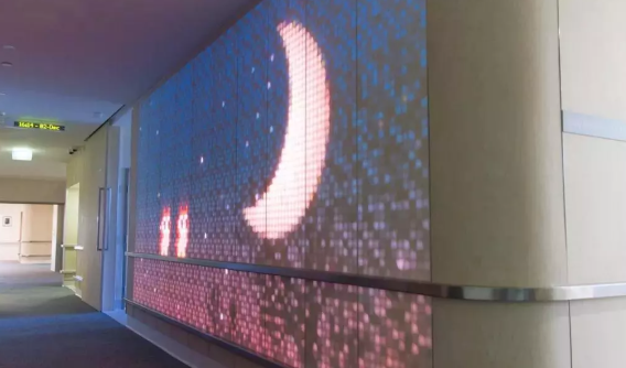
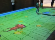
1. Define Your Project First (Before Choosing LiDAR)
Before comparing models, clarify:
- Interaction type: floor / wall / immersive
- Area size: small (<5m), medium (5–10m), large (10m+)
- User density: single user vs multi-user
- Environment: indoor, bright light, reflective surfaces
Engineering rule:
LiDAR selection should always follow the project—not the other way around
2. Coverage Range (Most Common Mistake)
Why Coverage Matters
Coverage determines:
- Number of devices required
- Installation complexity
- Cost
Key Parameters to Check:
- Detection radius (e.g., 10m, 13m)
- Scanning angle (e.g., 180°, 270°)
Practical Selection Guide
| Project Size | Recommended Coverage |
|---|---|
| Small (<5m) | Single LiDAR (basic range) |
| Medium (5–10m) | Wide-angle LiDAR |
| Large (>10m) | Multi-LiDAR system |
Engineering Insight:
Many projects fail because:
- Coverage is underestimated
- Blind zones appear at edges
Always design for full diagonal coverage, not just center area
3. Accuracy (What Really Affects User Experience)
Typical Accuracy Benchmarks
- ≤2 cm → High precision (recommended)
- 2–5 cm → Acceptable
- 5 cm → Poor interaction experience
What Affects LiDAR Accuracy
1. Distance
- Accuracy decreases with range
- Choose LiDAR designed for large-scale interaction
2. Installation Angle
- Incorrect angle → distorted mapping
- Must align with interaction plane
3. Calibration Quality
- Even high-end LiDAR fails without proper calibration
Engineering Conclusion:
Accuracy is not just a spec—it is a system-level result involving:
- Hardware
- Installation
- Software calibration
4. Installation Method (Critical for Deployment Efficiency)
4.1 PoE (Power over Ethernet) – Recommended
Advantages:
- Single cable (power + data)
- Faster installation
- Lower wiring complexity
4.2 Traditional Power + Data Separation
Limitations:
- More wiring
- Higher installation cost
- More failure points
Engineering Insight:
For commercial projects, PoE-based systems (like those from CPJROBOT) significantly reduce:
- Installation time
- Maintenance complexity
- Risk of wiring errors
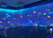
5. Multi-LiDAR Scalability (For Large Projects)
If your project includes:
- Large interactive floors
- Multi-wall immersive spaces
- Complex layouts (L-shape, curved surfaces)
You need to consider:
Key Factors:
- Multi-device synchronization
- Unique IP configuration
- Network stability
- Power supply capacity
Engineering Recommendation:
Choose LiDAR systems that support:
- 20+ device cascading
- Stable real-time synchronization
6. Environmental Adaptability
Key Risks in Real Projects
- Strong ambient light
- Reflective surfaces (tiles, glass)
- Dust or moisture
What to Look For
- Light resistance (TOF LiDAR preferred)
- IP rating (e.g., IP65)
- Stable detection in complex environments
Practical Insight:
Many failures are not caused by hardware defects—but by environment mismatch
7. Software Compatibility (Often Overlooked)
A good LiDAR must integrate easily with your system.
Check for:
- TUIO protocol support
- Windows touch compatibility
- SDK (C#, C++, Unity integration)
Engineering Reality:
Hardware without proper software support = unusable system
8. Cost vs System Value (Not Just Hardware Price)
Typical Misconception:
Choosing the cheapest LiDAR reduces cost.
Reality:
Total cost includes:
- Installation
- Debugging time
- Maintenance
- Rework
Engineering Conclusion:
The best LiDAR for interaction is not the cheapest—it is the one that:
- Minimizes deployment risk
- Reduces long-term maintenance
- Ensures stable operation
9. Common Selection Mistakes (From Real Projects)
- Choosing LiDAR based only on price
- Ignoring coverage range → blind zones
- Underestimating installation complexity
- Not planning multi-device scalability
- Overlooking environmental interference
10. How Engineers Typically Choose LiDAR
Step-by-step approach:
- Define project size and interaction type
- Calculate coverage area
- Select LiDAR based on range + angle
- Evaluate installation method (PoE preferred)
- Check software compatibility
- Plan scalability (if needed)
11. FAQ (Frequently Asked Questions)
Q1: What is the best LiDAR for interactive systems?
The best LiDAR depends on your project. For most commercial applications, TOF LiDAR with PoE support provides the best balance of performance and deployment efficiency.
Q2: How much coverage do I need?
Always design for full area coverage, including edges and corners. Underestimating coverage is a common mistake.
Q3: Is higher accuracy always better?
Yes, but only if properly installed and calibrated. Accuracy depends on the entire system, not just the sensor.
Q4: Why is PoE important?
PoE simplifies installation by reducing wiring, making it ideal for large commercial projects.
Q5: Can one LiDAR cover a large space?
For large spaces (>10m), you typically need multiple LiDAR units working together.
Choosing the right LiDAR is not about specs alone—it is about system reliability in real-world conditions.
A well-selected LiDAR system should:
- Cover the full interaction area
- Deliver stable accuracy
- Be easy to install and maintain
- Scale with project complexity
If you’re planning an interactive system and need help selecting the best LiDAR for interaction, working with an experienced manufacturer can reduce risk significantly.
CPJROBOT specializes in interactive LiDAR systems for commercial and immersive environments, with solutions designed for real deployment scenarios.