
What is LiDAR interactive projection?
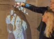
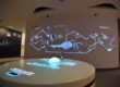
LiDAR interactive projection uses a light detection and ranging sensor to measure positions in or near a projected area. Software converts those measurements into interaction events, such as a touch-like contact, an entered zone, a step, or a tracked object. The application then updates the projected image.
LiDAR is the sensing layer, not the whole solution. A production system also needs projection, computing, calibration, interaction logic, content, mounting, power and data, and an operational plan.
How LiDAR detects touch and movement
At a high level, a LiDAR emits light and measures returned signals to estimate distance. Sensor architecture varies: some devices scan points or lines, while others capture a wider field. The resulting measurements can be represented as ranges, points, or a spatial map.
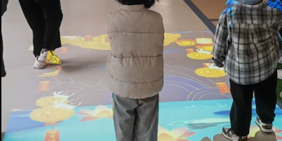
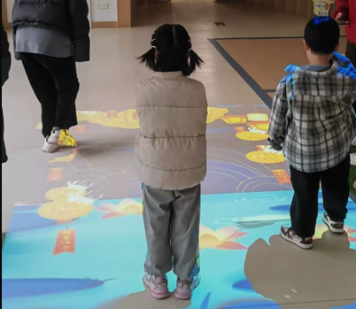
For a wall, the installer may define a reference plane corresponding to the surface. A hand approaching or crossing a configured distance from that plane becomes a candidate interaction. For a floor or open area, software can define zones and detect points or clusters that enter them.
Filtering is essential. The system must distinguish intended interaction from the wall or floor, mounting vibration, passers-by, temporary objects, noise, and measurement uncertainty. Thresholds that are too permissive produce false triggers; thresholds that are too strict miss valid input.
The main components
1. Projection system
The projector, lens, mounting, image geometry, and surface determine visibility and shadow behavior. Multiple projectors may require edge blending and geometric alignment.
2. LiDAR sensor layer
Sensor selection considers usable range, field of view, angular resolution, update rate, wavelength and eye-safety classification, environmental rating, interfaces, mounting, and target characteristics. Always use the manufacturer’s current safety and installation documentation.
3. Processing computer
The computer receives sensor data, runs detection and calibration logic, renders content, and outputs video. Performance requirements depend on input density, graphics complexity, display resolution, and the number of projectors.
4. Interaction middleware
Middleware transforms sensor coordinates into stable events the application understands. Functions may include background modeling, plane or zone configuration, clustering, debounce, tracking, coordinate mapping, diagnostics, and device health monitoring.
5. Interactive application and content
The application defines the user experience. It may use a game engine, a custom application, a browser-based front end, or an exhibit control platform. Sensor capability is useful only when the content provides clear and timely feedback.
6. Network, power, and control
Some LiDAR devices use Ethernet, and some support Power over Ethernet (PoE) so power and data can share one cable through compatible infrastructure. PoE does not mean every LiDAR is interoperable with every switch or software stack; confirm the supported standard, power budget, cable length, network addressing, bandwidth, and protocol.
How LiDAR, projection, and software work together
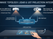
The data path is:
- The LiDAR measures the interaction area.
- Middleware filters measurements and identifies a candidate user action.
- Calibration transforms sensor coordinates into application or projector coordinates.
- The application changes its state.
- The graphics system renders the response.
- The projector displays the updated frame.
Each step contributes to end-to-end latency. This is why sensor frequency alone cannot describe how responsive the complete installation will feel.
Calibration: the critical integration step
Calibration establishes the relationship between the sensor’s coordinate system and the projected image. A common workflow identifies reference points or boundaries, fits a geometric transformation, and validates error across the full active area.
Good commissioning checks the center, edges, corners, different approach angles, and intended user heights. Calibration files should be backed up and tied to documented sensor and projector positions. If either device moves, validation—or recalibration—may be necessary.
Suitable project types
LiDAR may be considered for large interactive walls, floor zones, digital exhibits, public installations, touch-like projected interfaces, object or presence zones, and environments where color imagery is unnecessary or undesirable. It is not automatically suitable for every outdoor, high-precision, multi-user, or safety-critical use case.
A pilot should reproduce the real mounting geometry, surface, light conditions, user behavior, and content. This verifies the complete system rather than an isolated sensor specification.
Frequently asked questions
Does LiDAR record video?
LiDAR generally outputs distance-related measurements rather than conventional color video. However, spatial data can still have privacy and security implications, so access, retention, and disclosure should be designed responsibly.
Is PoE required?
No. It is an integration option on supported devices. It can simplify cabling, but power budget, network design, and redundancy still require planning.
Can LiDAR make any projection touch-sensitive?
Only when coverage, geometry, calibration, surface behavior, software, and interaction thresholds are suitable. A sensor alone does not create a finished touch interface.
Talk to CPJROBOT about LiDAR integration
For a useful technical discussion, provide an elevation drawing, active-area dimensions, sensor mounting options, projector positions, user behavior, expected accuracy, environment, network constraints, and application interface requirements.